HARMONIZE Brazil INPE
Earth Observation Data Cube tuned for Health Response Systems (EODCtHRS)
The HARMONIZE Project collates existing multi-source climate, environmental, socioeconomic and health data, and collects new longitudinal data using drone technology and low-cost weather sensors, to calibrate and downscale Earth Observation, climate reanalysis and seasonal forecast datasets in areas most relevant in Latin America and the Caribbean for disease transmission. The project focuses on five hotspots located in Colombia, Peru, the Dominican Republic and Brazil.
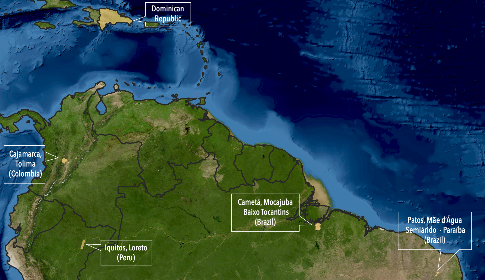
Figure 1 - HARMONIZE Project hotspots.
In the HARMONIZE, the Earth Observation Data Cube tuned for Health Response Systems (EODCtHRS) is a technical-scientific proposal termed HARMONIZE Instance composed of back/front-end solutions developed using free and open-source software for integration and interoperability between specific sets of health, environmental and climate data and the digital infrastructure of the Brazil Data Cube (BDC) project of the National Institute for Space Research (INPE).
Here we introduce the data collections and tools available in the HARMONIZE Instance. These collections integrates health and climate data and drone imagery for the hotspots in Brazil - “Baixo Tocantins” (lower Tocantins river basin in Pará state) and “Semiárido da Paraíba” (semiarid region in the Paraíba state) regions. These areas are particularly vulnerable to climate change. Baixo Tocantins is located in the humid Amazon region, which has faced increased flooding and deforestation pressure in recent years. Sertão da Paraíba is located in a semi-arid region that often faces water scarcity and periodic droughts, which increases the risk of food insecurity and infectious disease outbreaks.
EODCtHRS proposal is presented in this paper.
For more information on the HARMONIZE Project, please refer to this page.