Geospatial Data Science Environment (BDC Lab)
The Geospatial Data Science Environment (BDC-Lab) is designed to provide integrated geospatial data analysis tools connected directly to BDC data (Figure below). This approach eliminates the need to download large volumes of Earth Observation data, enabling researchers to conduct advanced analyses using RStudio, QGIS, Metview, VSCode, and Jupyter Notebooks, all equipped with a range of R and Python geospatial libraries. Currently, it is in an experimental phase, where some users are testing its functionalities and providing feedback for its improvement.
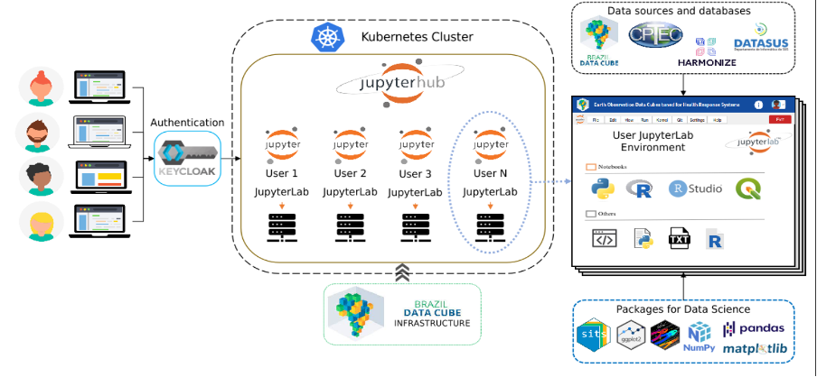
Figure 21 - Simplified BDC-Lab workflow.